For centuries, Japan has captured the imagination of the world with its samurai legends, cherry blossoms, feudal castles, and whispered tales of Shinto spirits. But to truly understand the heartbeat of old Japan, one must not only walk its cobblestone paths but also gaze upon its maps—the fragile, illustrated windows into how this island nation once saw itself. An ancient Japan map isn’t just parchment and ink. It’s a cultural tapestry. A storyteller. A portal.
These old scrolls and beautifully hand-painted sheets tell us more than do rivers and roads. They hint at emperors and monks, invaders and traders, gods and mountains. Their beauty is rivaled only by the secrets they keep, and they give a glimpse not only of geography, but of worldview.
Table of Contents:
Cartographers Drew the Islands With Poetry
When GPS was still just a fantasy and the world was more myth than reality, Japanese cartographers practiced their art with imagination rather than accuracy. An old Japan map was not created to be “accurate” in today’s language. Rather, it was symbolic, religious, and frequently lyrical.
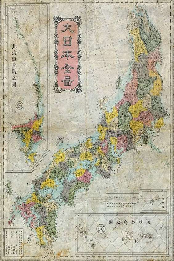
Instead of worrying about north-south orientation or mathematical scale, Japanese maps of Japan’s Heian, Kamakura, or Edo eras were more prone to highlight what was important—the spiritual significance of Mount Fuji, the centrality of Kyoto, or the distant menace of foreign lands. Mountains were made larger if they were holy. Shrines stood in bold, proud outline. And the palace of the emperor? Always at the center of the world.
It’s within this charming subjectivity that these maps are so interesting. They show the values, worries, aspirations, and identity of a nation. It’s reading a diary written using brushes and color pigments rather than words.
The Myth Meets Geography and Daily Life
Perhaps the most compelling of all the features on an ancient Japan map are the whirlpools, ghost creatures, and dragons.

These aren’t mistakes—they’re beliefs. And they were added as seriously as trade routes or coastal lines.
Posts from the same category:
- Oxalic Acid Gas Vaporizer for Effective Pest Control
- Basics of Eco-Friendly Homes in Slovenia
- How to Use Oxalic Acid Vaporizer
- The Insider’s Guide To Selling Sculptures
- Find the Best Slovenia Real Estate Near These Portorož and Piran Attractions